
The National Weather Service of Northern Indiana is informing that a major winter storm will bring a variety of hazards to the region for late Thursday into the weekend. A Winter Storm Watch has been issued. The NWS says major travel disruptions are expected and to plan ahead and keep up on the latest forecast over the next few days.
In a separate statement the National Weather Service of Northern Indiana announced the following:
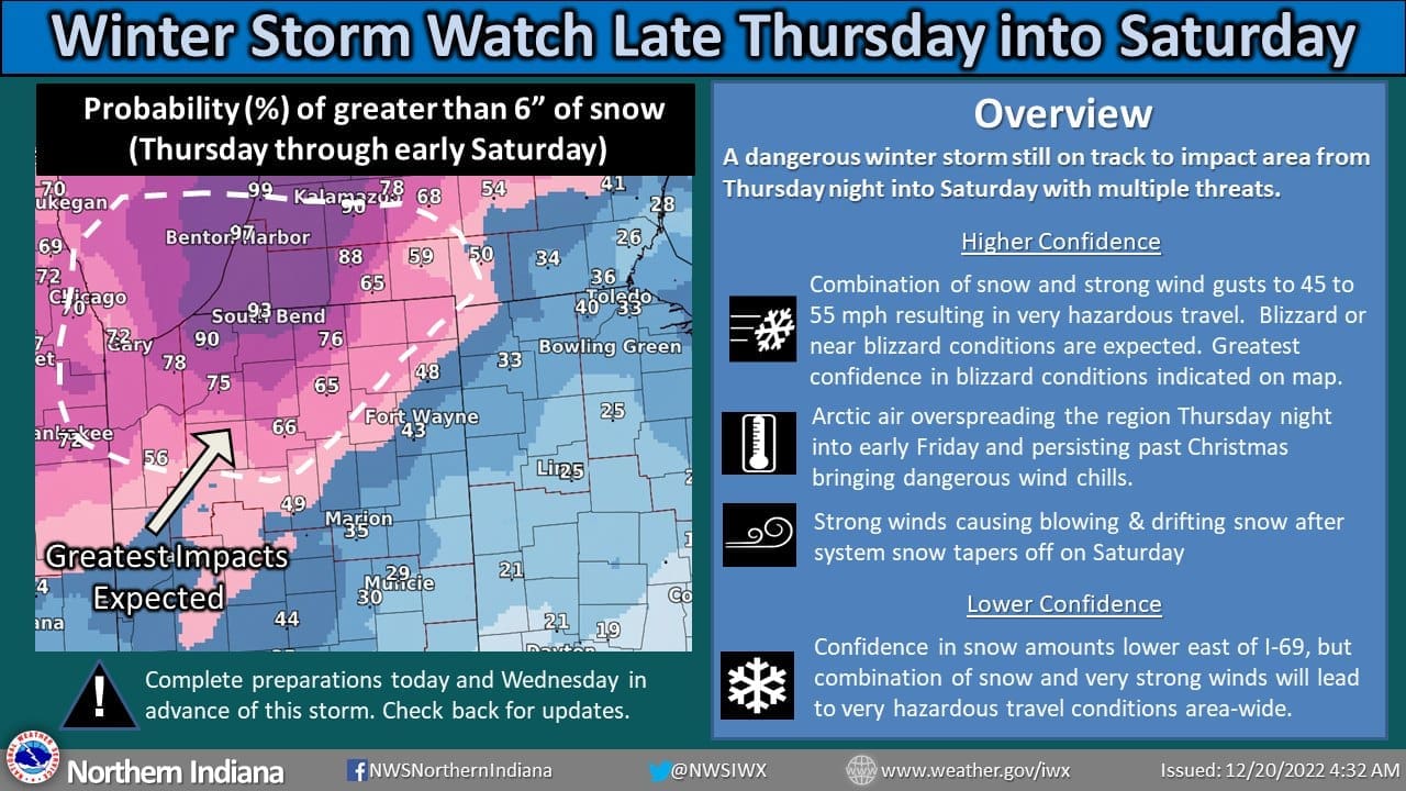
“A Winter Storm Watch has been issued for all of the forecast area from Thursday evening through Saturday morning. A light wintry mix early Thursday is expected to change to rain showers during the day Thursday. A strong winter storm will bring an arctic airmass into the area with a quick changeover to snow from west to east Thursday night into early Friday. Blizzard or near blizzard conditions are expected on Friday across the area with peak wind gusts of 45 to 55 mph leading to widespread blowing snow. Travel will likely become very difficult or impossible Friday into Friday night across at least portions of the area. The greatest confidence in blizzard conditions is indicated on the map where the greatest snow accumulations are expected, but very hazardous conditions are expected area-wide due to the combination of accumulating snow and very strong winds. Dangerous wind chills of 15 below to 30 below are expected Friday through the weekend, along with lake effect snow showers on the back side of this system.”