
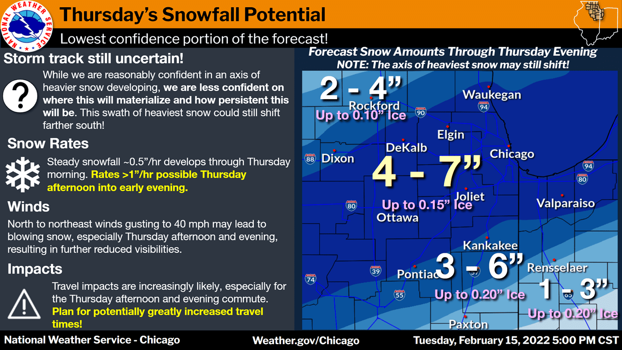
A winter storm watch is in effect from Thursday morning through Thursday evening for the counties of La Port, St. Joseph, Elkhart, Berrien, Cass (Michigan) and St. Joseph (Michigan).
Heavy mixed precipitation possible. Total snow accumulations of 4 to 7 inches and ice accumulations up to one tenth of an inch.
The National Weather Service says to plan on slippery road conditions Thursday afternoon and evening. The hazardous conditions will impact the evening commute.
A winter storm watch is also in effect for the counties Lake, Porter, Newton, Jasper and portions of northeast Illinois mainly along and south of I-88 and including much of the Chicago metro.
The National Weather Services is forecasting freezing rain and sleet late Wednesday night through Thursday morning, then snow and blowing snow Thursday morning through early Thursday evening.
The NWS says travel may become hazardous due to snow and ice covered roads and at times very low visibility including the Thursday morning and afternoon commutes.
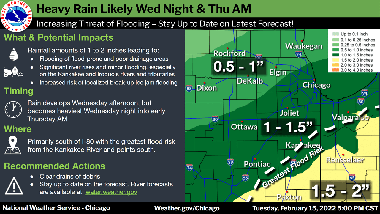
A flood watch is in effect from Wednesday evening through Thursday morning for Newton, Jasper, and Benton counties and portions of east central Illinois
The NSW says flooding caused by heavy rain, snowmelt, and break up ice jams is possible.
The NWS says excessive runoff may result in flooding of rivers, creeks, streams, and other low-lying, flood-prone, and poor drainage areas. Some river points are forecast to go above flood stage based on the current forecast rainfall amounts. Rising river levels and warmer temperatures may result in river ice becoming dislodged, increasing the risk of localized ice jam flooding.
For this area the NWS says rainfall of one to two inches is expected Wednesday night into Thursday morning which will be falling on frozen ground, leading to quick runoff.
See more at www.weather.gov/safety/flood .
A Flood Watch means flooding is possible, but not yet certain, based upon the latest forecasts. Persons with interests along area rivers, creeks, and other waterways should monitor the latest forecasts and be prepared to take action should flooding develop.