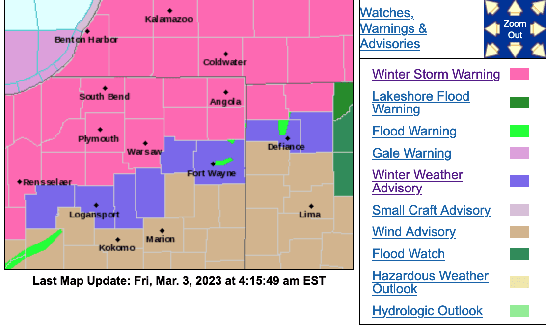
Multiple Winter Storm Warnings are in effect for the area.
For the counties of Elkhart, Lagrange, Steuben, Noble, De Kalb, Starke, Pulaski, Marshall, Fulton IN, Northern La Porte, Eastern St. Joseph IN, Northern Kosciusko, Southern La Porte, Western St. Joseph IN, Southern Kosciusko, Cass MI, St. Joseph MI, Branch, Hillsdale, Northern Berrien, Southern Berrien, Williams, and Fulton OH:
…WINTER STORM WARNING IN EFFECT FROM NOON EST /11 AM CST/
FRIDAY TO MIDNIGHT EST /11 PM CST/ FRIDAY NIGHT…* WHAT…Heavy snow expected. Isolated thunderstorms possible.
Total snow accumulations of 4 to 8 with isolated higher amounts
around 10 inches. Winds gusting as high as 45 mph.* WHERE…Portions of northern Indiana, southwest Michigan and
northwest Ohio.* WHEN…From noon EST /11 AM CST/ Friday to midnight EST /11 PM
CST/ Friday night.* IMPACTS…Travel could be very difficult. The hazardous
conditions could impact the evening commute. The combination of
gusty winds and heavy, wet snow could bring down tree branches
and lead to power outages.* ADDITIONAL DETAILS…Snowfall rates in excess of 1 inch per hour
are expected.PRECAUTIONARY/PREPAREDNESS ACTIONS…
If you must travel, keep an extra flashlight, food, and water in
your vehicle in case of an emergency.
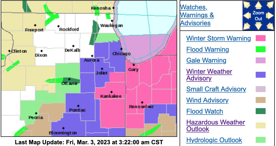
Another Winter Storm Warning is in effect for the counties of Kankakee, Iroquois, Eastern Will, Lake IN, Porter, Newton, Jasper:
…WINTER STORM WARNING IN EFFECT FROM NOON TO 10 PM CST FRIDAY…
* WHAT…Heavy wet snow accumulations, intense snow rates, strong
northeast winds, low visibility, and dangerous travel conditions
expected. Total snow accumulations of 4 to 8 inches expected
with locally higher amounts. In addition, northeast winds will
gust in excess of 45 mph.* WHERE…Portions of east central and northeast Illinois and
northwest Indiana.* WHEN…From noon to 10 PM CST Friday.
* IMPACTS…Travel will become difficult and dangerous, including
during the Friday afternoon and evening commute. The
combination of heavy, wet snow accumulations on trees and strong
northeasterly winds may lead to downed tree limbs and localized
power outages.* ADDITIONAL DETAILS…Snow rates of 2 to 3 inches per hour and
thundersnow may occur within a narrow but intense band of snow.
This will cripple travel conditions including during the
afternoon and evening commute.PRECAUTIONARY/PREPAREDNESS ACTIONS…
If you must travel, keep an extra flashlight, food, and water in
your vehicle in case of an emergency.In Illinois, the latest road conditions for Illinois can be
obtained on the internet at www.gettingaroundillinois.com. In
Indiana, the latest road conditions for Indiana are available by
calling 1-800-261-7623.