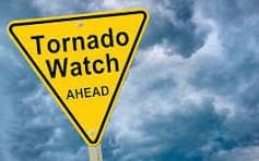
TORNADO WATCH and HAZARDOUS WEATHER OUTLOOK-be prepared-see the COUNTIES below
TORNADO WATCH 99 IS IN EFFECT UNTIL 1000 PM CDT FOR THE
FOLLOWING LOCATIONS
INDIANA COUNTIES INCLUDED ARE
BENTON BOONE BROWN
CARROLL CASS CLAY
CLINTON DAVIESS FOUNTAIN
FULTON GRANT GREENE
HAMILTON HENDRICKS HOWARD
JASPER JOHNSON KNOX
KOSCIUSKO LAKE LAWRENCE
LA PORTE MARION MARSHALL
MARTIN MIAMI MONROE
MONTGOMERY MORGAN NEWTON
OWEN PARKE PORTER
PULASKI PUTNAM STARKE
SULLIVAN TIPPECANOE TIPTON
VERMILLION VIGO WABASH
WARREN WHITE
Hazardous Weather Outlook
National Weather Service Northern Indiana
344 PM EDT Wed Apr 2 2025
This Hazardous Weather Outlook is for northern Indiana and
southwest Michigan.
.DAY ONE…This afternoon and tonight.
Thunderstorms are expected to develop later this afternoon and
evening. All severe hazards are possible including heavy rain and
tornadoes. The risk of severe storms is greatest along and south of
the US 24 corridor.
.DAYS TWO THROUGH SEVEN…Thursday through Tuesday.
Additional rounds of rainfall late Friday through late Saturday.
Widespread hazardous weather is not expected at this time.
.SPOTTER INFORMATION STATEMENT…
Weather spotters are encouraged to report significant weather
conditions according to Standard Operating Procedures.