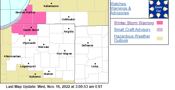
A Winter Storm Warning remains in effect for parts of the WIMS listening area.
The following is Tuesday night’s update from the National Weather service:
“337 AM EST Wed Nov 16 2022
…WINTER STORM WARNING REMAINS IN EFFECT UNTIL 10 AM EST /9 AM
CST/ THURSDAY…
* WHAT…Heavy, wet lake effect snow. Total snow accumulations of
5 to 10 inches. Locally higher amounts around 1 foot possible
near the Indiana, Michigan stateline in northern La Porte and
southern Berrien counties. Peak snowfall rates of 1 to 2 inches
per hour possible this afternoon into early tonight.
* WHERE…Portions of northern Indiana and southwest Michigan.
* WHEN…Until 10 AM EST /9 AM CST/ Thursday.
* IMPACTS…Travel will become very difficult. The hazardous
conditions will impact the morning and evening commutes.
PRECAUTIONARY/PREPAREDNESS ACTIONS…
If you must travel, keep an extra flashlight, food, and water in
your vehicle in case of an emergency.”
Additional updates throughout the day can be found at www.weather.gov/iwx