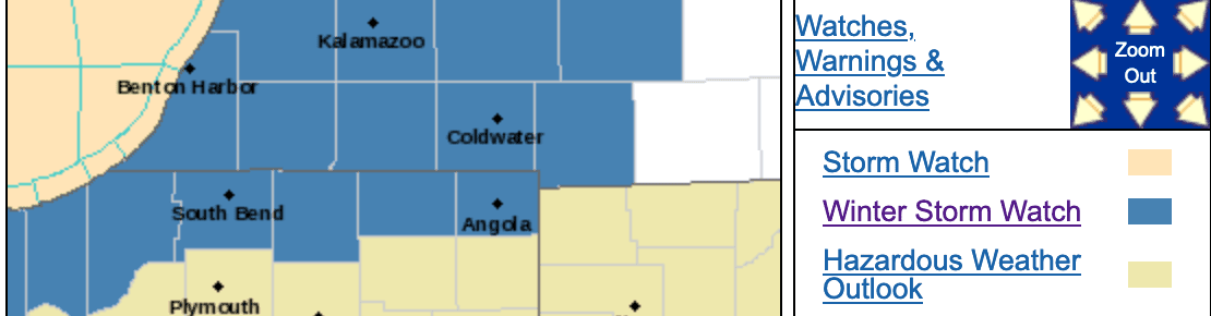
A winter storm watch has been issued for portions of the WIMS listening area for a possible winter storm Friday morning through Saturday afternoon.
The following statements were given Wednesday night from the National Weather Service of Northern Indiana and the National Weather Service of Chicago.
From the National Weather Service of Northern Indiana:
…WINTER STORM WATCH REMAINS IN EFFECT FROM FRIDAY MORNING
THROUGH SATURDAY AFTERNOON…* WHAT…Heavy snow possible. Total snow accumulations in excess
of 6 inches possible. Winds could gust as high as 35 to 45 mph.* WHERE…Portions of northern Indiana and southwest Michigan.
* WHEN…From Friday morning through Saturday afternoon.
* IMPACTS…Travel could be very difficult. Areas of blowing
snow could significantly reduce visibility. The hazardous
conditions could impact the Friday evening commute. Gusty
winds could bring down tree branches.* ADDITIONAL DETAILS…Conditions are expected to deteriorate
through the day Friday. Wind gusts from the west of 35 to 45 mph
are possible Friday night and Saturday. Bitterly cold air will
spread across the area Saturday night causing wind chills to
fall to near 10 below zero.PRECAUTIONARY/PREPAREDNESS ACTIONS…
Monitor the latest forecasts for updates on this situation. If you
must travel, put together a winter emergency kit that you can take
with you that includes blankets, a fully charged cell phone,
water, high energy snacks, a bag of sand or cat litter, a tow rope
and a flashlight.
From the National Weather Service of Chicago:
…WINTER STORM WATCH REMAINS IN EFFECT FROM FRIDAY MORNING
THROUGH SATURDAY MORNING…* WHAT…Heavy snow and blowing snow possible. Total snow
accumulations greater than 6 inches possible. Winds could gust
as high as 45 to 50 mph.* WHERE…Portions of northeast Illinois and northwest Indiana.
* WHEN…From Friday morning through Saturday morning.
* IMPACTS…Travel could be dangerous. Areas of blowing snow
could significantly reduce visibility. The hazardous
conditions will likely impact both Friday commutes. Gusty
winds could bring down tree branches.* ADDITIONAL DETAILS…The strongest winds with the potential
for periods of blizzard conditions are expected Friday evening
into early Saturday. Warmer temperatures near Lake Michigan
will likely cut into snow accumulations during the day on
Friday.PRECAUTIONARY/PREPAREDNESS ACTIONS…
Monitor the latest forecasts for updates on this situation.