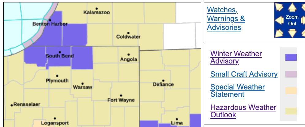
There is a Winter Weather Advisory in effect for the counties of northern La Porte, St. Joseph (IN), Cass (MI), and Berrien.
…WINTER WEATHER ADVISORY REMAINS IN EFFECT UNTIL 7 PM EST /6 PM
CST/ THURSDAY…
* WHAT…Lake effect snow expected. Total snow accumulations between
2 and 6 inches.
* WHERE…Portions of northern Indiana and southwest Michigan. The
heavier snow totals and greater impacts are expected across
northern St Joseph County IN and Berrien County MI.
* WHEN…Until 7 PM EST /6 PM CST/ Thursday. Snow showers will be
light and scattered late this afternoon into this evening. The
heavier lake effect snow develops after midnight and continues at
times through the day Thursday.
* IMPACTS…Roads, and especially bridges and overpasses, will
likely become slick and hazardous. Plan on slippery road
conditions and visibilities reduced to a quarter of a mile or less
in heavier snow bands. The hazardous conditions will impact the
Thursday morning and Thursday evening commutes.
PRECAUTIONARY/PREPAREDNESS ACTIONS…
Slow down and use caution while traveling. The latest road
conditions for the state you are calling from can be obtained by
calling 5 1 1.
During lake effect snow, the weather can vary from bands of locally
heavy snow to dry weather just a few miles away. Visibilities can
also vary greatly. Be prepared for rapid changes in weather,
visibility, and road conditions.