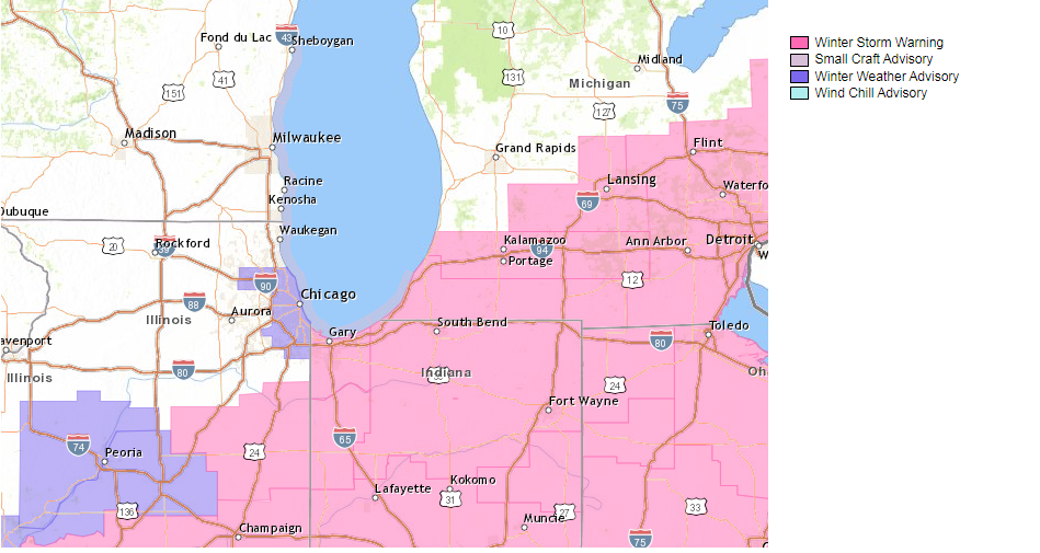
The following are Winter Storm Warning messages from the National Weather Services of Northern Indiana and Chicago:
URGENT - WINTER WEATHER MESSAGE
National Weather Service Northern Indiana
1103 PM EST Wed Feb 2 2022

INZ003>008-012>016-020-022-MIZ077>081-031215-
/O.CON.KIWX.WS.W.0002.000000T0000Z-220204T0000Z/
La Porte-St. Joseph-Elkhart-Lagrange-Steuben-Noble-Starke-Pulaski-
Marshall-Fulton-Kosciusko-White-Cass-Berrien-Branch-Hillsdale-
Including the cities of Michigan City, La Porte, South Bend,
Mishawaka, New Carlisle, Walkerton, Elkhart, Goshen, Nappanee,
Lagrange, Topeka, Shipshewana, Angola, Fremont, Kendallville,
Ligonier, Albion, Knox, North Judson, Bass Lake, Winamac,
Francesville, Medaryville, Plymouth, Bremen, Culver, Rochester,
Akron, Warsaw, Winona Lake, Syracuse, Mentone, Monticello, Monon,
Brookston, Logansport, Royal Center, Niles, Benton Harbor,
St. Joseph, Fair Plain, Benton Heights, Buchanan, Paw Paw Lake,
Dowagiac, Cassopolis, Edwardsburg, Marcellus, Sturgis,
Three Rivers, White Pigeon, Mendon, Coldwater, Bronson,
Hillsdale, Jonesville, and Litchfield
1103 PM EST Wed Feb 2 2022 /1003 PM CST Wed Feb 2 2022/

...WINTER STORM WARNING REMAINS IN EFFECT UNTIL 7 PM EST /6 PM
CST/ THURSDAY...

* WHAT...Heavy snow with blowing and drifting snow. Additional
  snow accumulations of 2 to 6 inches by Thursday evening. Winds
  gusting as high as 35 mph.

* WHERE...Portions of northern Indiana and southwest Michigan.

* WHEN...Until 7 PM EST /6 PM CST/ Thursday.

* IMPACTS...Travel will be very difficult, into Thursday
  evening. Areas of blowing snow are expected tonight into
  Thursday evening. The hazardous conditions will impact all
  commutes through Thursday evening.

* ADDITIONAL DETAILS...While a lull in the snow exists early
  tonight, the snow is expected to move back in for southeastern
  areas as another wave comes back in starting late tonight and
  early Thursday morning and continuing Thursday. The
  northwestern extent of this area of snow is uncertain as
  drier/colder air comes in and likely creates a sharp cutoff on
  that northern end. Additional accumulations of a trace to 3
  inches can be expected along with blowing and drifting of snow
  on east to west and mainly rural roads.

PRECAUTIONARY/PREPAREDNESS ACTIONS...

This storm will bring dangerous driving conditions through
Thursday. Unplowed roads are likely to become impassable in many
areas. Plummeting wind chills accompanied by blowing and drifting
snow could bring a potentially lethal travel situation with wind
chills falling below zero if you become stuck in your vehicle
later Thursday/Thursday night. Plan now to make any needed travel
changes to avoid travel during this time. Monitor the latest
forecasts for updates on this winter storm. If you must travel,
keep an extra flashlight, food, and water in your vehicle in case
of an emergency.
URGENT - WINTER WEATHER MESSAGE
National Weather Service Chicago IL
906 PM CST Wed Feb 2 2022

INZ001-002-031115-
/O.EXT.KLOT.WS.W.0003.000000T0000Z-220203T1600Z/
Lake IN-Porter-
Including the cities of Gary, Hammond, Merrillville, Portage,
Valparaiso, and Chesterton
906 PM CST Wed Feb 2 2022

...WINTER STORM WARNING NOW IN EFFECT UNTIL 10 AM CST THURSDAY...

* WHAT...Treacherous travel tonight due to areas of blowing and
  drifting snow, mainly in open and exposed locations, as well as
  light lake effect snow showers. Additional snow accumulations
  of up to one inch through Thursday morning.

* WHERE...Portions of far northwest Indiana.

* WHEN...Until 10 AM CST Thursday.

* IMPACTS...Plan on snow covered roads and slippery road
  conditions due to blowing snow tonight. Some of this may
  continue on Thursday morning and impact the morning commute.

PRECAUTIONARY/PREPAREDNESS ACTIONS...

If traveling, keep an extra flashlight, food, and water in your
vehicle in case of an emergency.

The latest road conditions for Indiana are available by calling 1-
800-261-7623.